Faster Image Discovery
Accelerates time to locate imagery from days to minutes

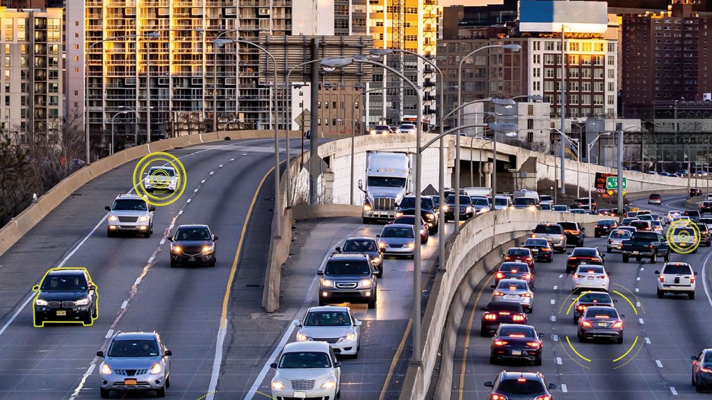
Automated Image Geolocation
GeoPoint is commercially available and NIPR-accessible service that provides rapid, automated image/ video geolocation and reporting. GeoPoint fuses information from geospatial databases, PAI/CAI and other sources using specialized AI/ML to geolocate images taken from cellphones, surveillance cameras and low-flying UAV’s.
AV’s ground-breaking technologies for multi-modal and multi-view AI accelerate analytical workflows and provide critical geospatial insights which otherwise be impossible using conventional methods.
3-5 minutes per image
Global Coverage: > 250M+ images > 9B map nodes
Commercial Internet, NIPRNet
KML, GeoJSON, CSV, Excel, PDF, .docx
Faster Image Discovery
Accelerates time to locate imagery from days to minutes
Eliminate Dead Ends
Rapidly identifies non-locatable photos with confidence assessment to save analysts’ time
Transparent Verification
Situational and contextual reporting offer rapid and explainable verification
Seamless Platform Integration
Integrates with AV’s proven PAI analysis platform to provide enhanced geospatial awareness
Secure, Flexible Access
Accessible on multiple networks, or on-prem deployment for secured applications
Related Solutions